Subscribe . Unsubscribe . Previous Newsletters

|
|
| A Monthly Publication of the CGA at Harvard University | July 2018 |
| HIGHLIGHTS |
| CGA NEWS |
|
Dr. Roland Wagner visited Harvard on June 26th and presented Technology Ages in IT and GeoIT for a CGA lunch seminar. Slides and Audio of the seminar available here. |
| HARVARD GIS COMMUNITY NEWS |
|
Harvard Map Collection celebrates it's 200th Anniversary with a special exhibition, Follow the Map which opened on June 26th. A symposium to celebrate 200 years of the collection will be held on October 25th - 26th.
|
| CGA ASSOCIATE PUBLICATIONS |
|
"Association of Prenatal Exposure to Population-Wide Folic Acid Fortification With Altered Cerebral Cortex Maturation in Youths."
|
|
"Hypermap Registry: an open source, standards-based geospatial registry and search platform."
|
| CONFERENCES, CALLS & JOBS | |
|
Conference: Geospatial Artificial Intelligence: Machine Learning in Earth Sciences, will be a session of AGU 18, Washington D.C. See Session ID 50531, when applying. Deadline: Aug 1st, 2018 |
|
|
Conference: As part of GIS-Pro & CalGIS 2018, in Palm Springs, California (October 9-12, 2018), URISA's Vanguard Cabinet of Young Professionals is organizing Inspiring the Future of GIS. University students are encouraged to enter the Lightning Talks Competition Deadline: Aug 31st, 2018 |
|
| NEWS ON GIS RESEARCH AND SERVICES | |||
|
|
|
|
|
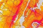
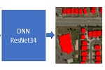
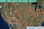
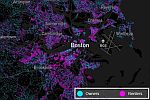
National Transportation Noise Map of the U.S. [USDOT & ESRI] 125 million Building Footprints with AI and Deep Learning [Microsoft] Seperados / TornApart map of ICE immigration facilities [Mobilized Humanities] Owners vs. Renters dot density map of the U.S.A. [Ryan McCullough] More on how the map was made here. Wayback – 81 Flavors of World Imagery [ESRI] EarthTime maps to visualize population movements and cities around the world. [BBC Video] Urban Data Pioneers are using data and maps to improve urban life in Tulsa. [CityLab] Deploying drones to map lava flows during volcanic eruption. [CRASNAR at Texas A&M] U.N. Economic and Social Council adopted a "Strategic Framework on Geospatial Information and Services for Disasters" on 2 July 2018. [United Nations] |
|||
|
The CGA Newsletter is published monthly. Editor of this issue: Lex Berman. |
CGA Home Page . Contact us . Follow us on Twitter
| This newsletter passes on news items and information about new web maps or uses of GIS that come to the CGA's attention from various sources. These are provided for informational purposes only. The CGA does not endorse these items and makes no representations about their accuracy, completeness or quality. © Present & Fellows Harvard University. All Rights Reserved. |
